Exporting a Structured .e57/RCP from Cyclone Register 360
Cyclone Register 360 is a point cloud processing and analysis software for 3D laser scanning professionals, providing automated tools and workflows specifically for point clouds. This enables users to import point cloud data, process, analyze, and quickly create high-quality deliverables for clients.
General Information
The .e57 format can store point cloud data from laser scanners and other 3D imaging systems, as well as 2D images and associated basic metadata. To better understand the e57 format, make sure to read the article "Understanding E57 Files."
With Cyclone Register 360, you can export:
- A structured e57 with all stations inside (recommended for the platform)
- A structured e57 for each station (not recommended for the platform)
- A unified e57 (not recommended, as you will lose structure and bubble view capability)
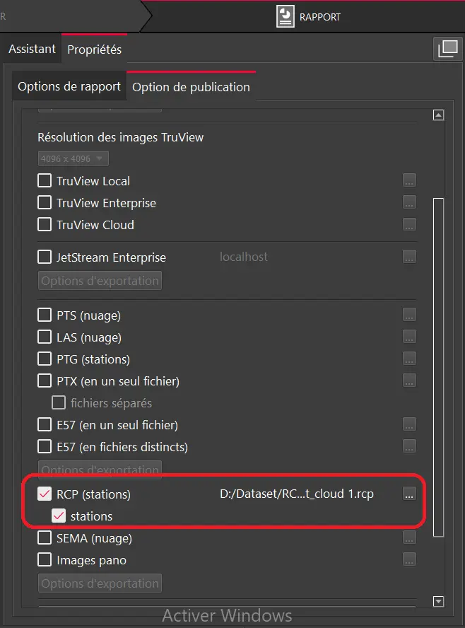
Please note that if you have the Cyclone REGISTER 360 PLUS version 2023.0, the 360 images are not kept the same way in the E57. If this is your case, we recommend you to update your version or exporting a structured RECAP project instead :
 For more information on how to upload the RECAP project, you can follow this link: Import a RECAP project.
In this article, we will discuss how to export a structured e57 with all stations inside.
Export a structured .e57 using Cyclone Register 360 :
- Once the processing and registration process is complete, open the "Report" using the toolbar icon at the top right of the window.

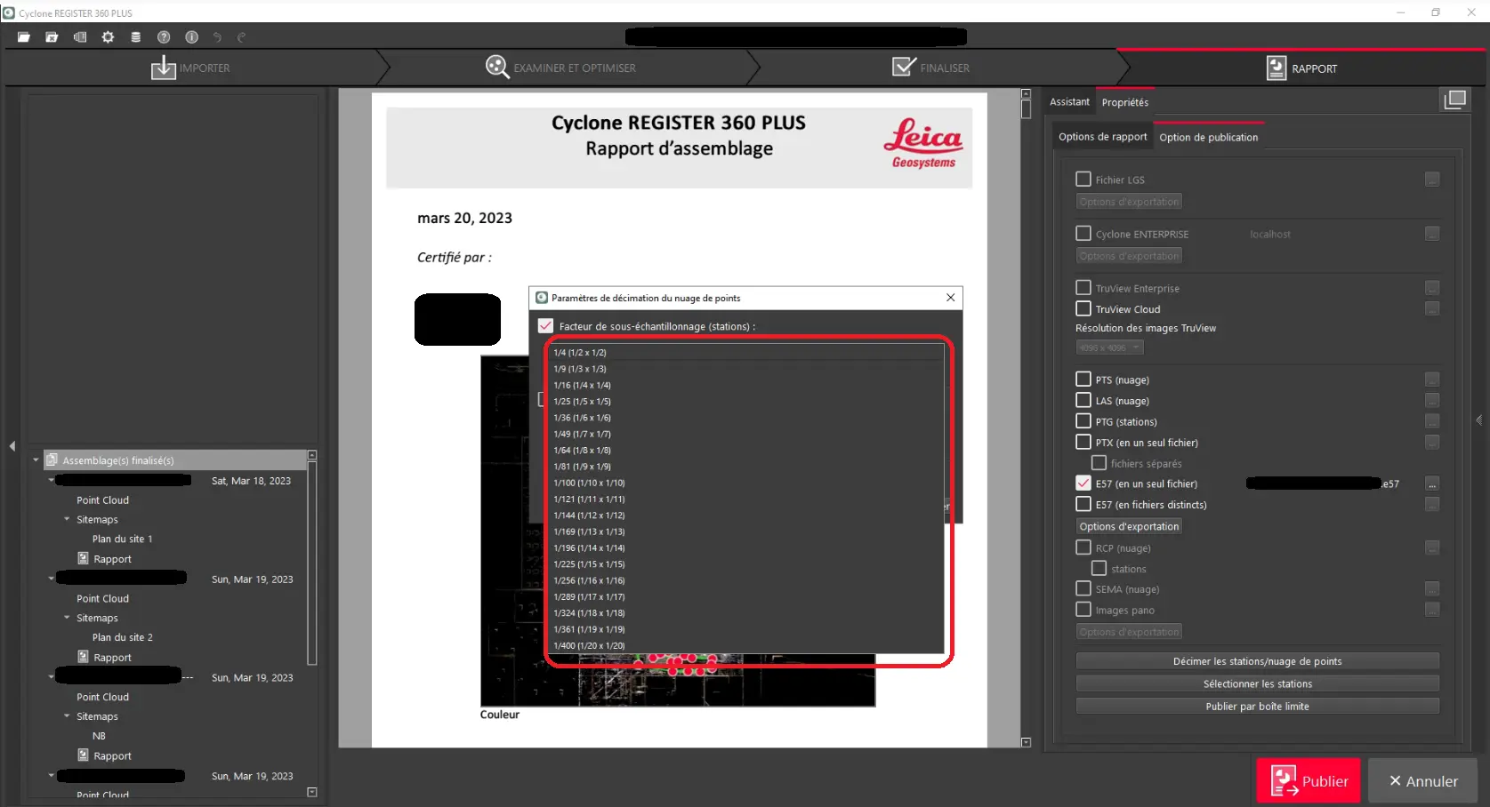
2. Next, from the "Publishing Options" click on the export option and check "Separate Configurations (structured, unstructured)."

3. Once the export option is configured, check "E57 (in a single file)." A new window will open where you can choose the export location.

4.(Optional) You can also decimate your point cloud according to your preferences by clicking on "Decimate stations/point clouds."

This process may take some time, depending on the number of point clouds and stations.
Once this process is complete, you can share the e57 file via our platform by adding it to a project as a source.
To learn how to upload a file to a project, please read the article "Adding Files to a Project."
Please note that for Register 360, the e57 will have 360° images stored inside. And when you upload the project to the platform, you will be able to download them.
If you have any questions or need further information, please contact the technical team.